|
|
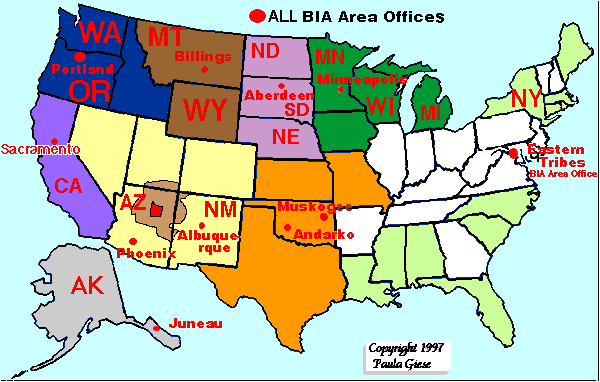
The information on this page had become badly out of date. Links from the map above now take you to an updated listing of tribal contact information, including websites, when available. To go directly to the complete index, follow this link! This section will not be updated. If a state's abbreviation is indicated in RED, there is an info file for that state's tribes; links supplied in the table below. Map is color coded for areas administered by BIA Area Offices. White States:No currently federally recognized tribes. Unrecognized groups may be petitioning for recognition.
|
| Page |
Menu |
Menu |
|---|
|
Text, maps and graphics copyright Paula Giese, 1997 CREDITS: Tribal names and placements on the map come from the maps and data in Veronica Tiller's "American Indian Reservations and Trust Areas", Economic Development Administration, U.S. Department of Commerce, 1996. Tribal listings modified from the BIA webserver. Last Updated: 4/5/97 |