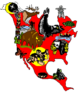
U.S. TRIBES by REGIONS and STATES (Big GIS effort)
 U.S. map showing federally owned lands including reservation trust lands, National forests, parks, etc. Overview for larger reservations, from whose treaty-determined original boundaries national forest and other national lands were most often carved. Not an imagemap. U.S. map showing federally owned lands including reservation trust lands, National forests, parks, etc. Overview for larger reservations, from whose treaty-determined original boundaries national forest and other national lands were most often carved. Not an imagemap.
Judicially-established Indian Lands Status in 1978 of court-proven aboriginal occupancy territories within the US. Click on the large regions for details of the established areas (a table of data on each tribe is below these detail region maps). Prepared by employees of the Army Corps of Engineers (it doesn't show any Indian lands they drowned.)
U.S. State Native American Populations 12K map from the 1990 census, can be downloaded and printed for classroom handouts (will print OK in black and white). Detail statistics for all federal and state tribes by keyword searching, or use the window at the bottom of the screen where all appear in alphabetical order. PC Statistical software for tribal population modeling (based on blood quantums of members), was done for PhD, used Hupa (CA) tribe as model. No Mac version. Compare Native to US general population, state by state in this interactive map-based analysis with several factors you can experiment with -- set to Minnesota right now.
 US MAP WINDOW INDEX -- Click on State for tribes therein; click on BIA Area Office for all tribes in that Area. State list also has links to other sites with info for those tribes. Clickable imagemap. Active states: MN, CA, AK, WI, MI, ND, SD; NY; AZ, NM, NE, MT, WY, WA added 4/4/97, OR added 4/6/97. Map GIS window is followed by alphabetical listing of all U.S. tribes, with clickable state pages. US MAP WINDOW INDEX -- Click on State for tribes therein; click on BIA Area Office for all tribes in that Area. State list also has links to other sites with info for those tribes. Clickable imagemap. Active states: MN, CA, AK, WI, MI, ND, SD; NY; AZ, NM, NE, MT, WY, WA added 4/4/97, OR added 4/6/97. Map GIS window is followed by alphabetical listing of all U.S. tribes, with clickable state pages.
Index listing of federally recognized tribes-by-states (with non-recognized following recognized lists)
Federally non-recognized tribes, by state List was originally researched by Prof. Troy Johnson, California State University, Long Beach. Redone, errors corrected, it was almost unusable because of Frames coding errors.
FAQ and Study Guide about tribes -- recognized, unrecognized: Legal, land, money, and individual tribal members cultural, personal, historical values
Minnesota Reservations map and info on each tribe. Even if you are not from Minnesota, you may find a current and historical info package, organized around a handy, clickable map, a good way to do some Native American minority-diversity teaching and learning that looks at current situations, land, notable people, links. 2/2/97 All Minnesota treaties: 2/14/97 NOTE: Envirotext Treaties database seems to be broken. 4/4/97
ALASKA Tribes contact info, organized links, tribal and regional maps. AK has over 200 organized Native entities.
CALIFORNIA has over 100 surviving tribes, and a complex history. Imagemaps organize and access California Native info, both as provided on this site and as found throughout the web.
MAP WINDOWS ALSO OPEN on tribes from: Wisconsin, Michigan, North Dakota, South Dakota, New York State, Arizona, New Mexico; Nebraska; Montana, Wyoming, Washington, Oregon. Use US map window index. 4/5/97
|